
9: Culminating Activities
Using CoCoRaHS data to explore student-generated questions
Purpose
As a culmination of student learning across previous months, the purpose of this final project is to support students as they apply and communicate what they have learned. Students will use CoCoRaHS data to answer a question they generate.

Ask students to discuss the various tools they have used throughout the year from the CoCoRaHS website to examine precipitation data they and other stations have collected. Ask these small groups to create a concept map (see Science/Literacy support below) highlighting these various tools and their uses for examining and exporting data across the United States.
Remind students that they have been contributing to this database all year. Those data are available for their use as a resource to investigate their own questions of interest. Assist students individually, or in small groups, in generating questions about precipitation beyond their station that they could answer using historical CoCoRaHS data.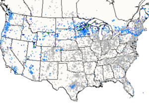 Allow time for students to access the tools on the CoCoRaHS website to obtain the data needed to answer their questions; they can use their concept maps as a guide. Support students as they analyze and interpret data, providing tools for representing data and posing questions to further students’ thinking. Encourage students to draw on what they have learned throughout the year to help them make sense of the data and answer their questions. Provide time for students to share their findings with peers or other target audience.
Standards + Practices
science
DCI: ESS2.C The Roles of Water in Earth’s Surface Processes
ESS2.D Weather and Climate
CCC: Cause and Effect
SP1: Asking questions and defining problems
Students will generate and answer their own questions which can be researched using CoCoRaHS historical data and tools.
SP4: Analyzing and interpreting data
Students will analyze and interpret data as they explore their own questions regarding historical data on the CoCoRaHS website.
SP6: Constructing explanations
Students will construct explanations for their questions using data and tools from the CoCoRaHS website.
SP8: Obtaining, evaluating, and communicating information
Students will communicate what they have learned to an audience.
mathematics
MP1: Make sense of problems and persevere in solving them
MP2: Reason abstractly and quantitatively
MP3: Construct viable arguments and critique the reasoning of others.
MP5: Use appropriate tools strategically
Resources + Supports


Ms. Clark’s Students Investigate Precipitation Nationwide
Ms. Clark wants to leverage students’ excitement regarding the CoCoRaHS participatory science project, so she decides to devote her dedicated science time one day in early May to offer students an opportunity to generate questions they would like to investigate using historical CoCoRaHS data. Ms. Clark wants to be receptive to all student ideas while also helping students to understand what makes a question investigatable. She begins the class by asking students to write down possible questions on sticky notes, reassuring students that writing down a question does not commit them to investigating the question. Instead, generating many ideas will help everyone in the class find something they are interested in exploring. Seeing that her students will develop a wide range of questions, Ms. Clark decides it will be necessary to explicitly discuss with students how to recognize investigatable questions.
Students place the sticky notes, with one question on each, on a piece of chart paper. Because the goal of these student-directed investigations is to have students deepen their understanding by accessing CoCoRaHS data, Ms. Clark first engages the class in a sorting activity where they determine which questions can be answered using CoCoRaHS data.
Several students pose questions related to the impacts of precipitation on communities and wildlife, such as “Where do animals go when it floods?” and “What happens to plants when there’s too much rain?” Ms. Clark asks students to consider resources and tools available on the CoCoRaHS website and whether these could be used to answer the questions. Ultimately, the class determines they will not be able to answer questions related to impacts, though these would still be interesting to research at another time. These questions and others that cannot be investigated using the CoCoRaHS database (e.g., How do you become a meteorologist?) are placed into an “Other Interesting Questions” category on a separate piece of chart paper. Examples of investigatable questions include:

Ms. Clark begins grouping questions on the chart paper and creating categories such as “Differences in Precipitation Over Time” and “Differences in Precipitation by Location.” Ms. Clark also asks students questions to help them refine their questions. For example, she asks students interested in investigating precipitation in a desert to identify a particular area in the United States designated as a desert, has them check the CoCoRaHS interactive map to make sure that precipitation data are available in this area, and consider what tools they could use to help generate these data.
Throughout the rest of the month, Ms. Clark allows students to use designated class time, as well as other smaller increments of available time (e.g., morning work, after finishing an assignment early) to continue investigating their questions. At the end of the year, Ms. Clark invites families into the classroom for a gallery walk to share what students have been investigating, as well as their work throughout the entire year.

Investigation Ideas
Throughout the year, students have been gathering and making sense of their data as well as data from a station in their region and another region, and during this activity, they will have the opportunity to apply what they have learned to investigate a topic of their choosing. These ideas should connect to standards covered throughout the year. Students may consider
- investigating daily weather changes in other states
- investigating other patterns of weather data, such as snowfall, hail, or other significant weather
- predicting upcoming weather events based on historical data on the website
- Investigating geographic features that influence weather
- comparing the precipitation of their state with another state they’ve visited
- investigating the precipitation data for a state they are going to visit on summer vacation, or where family members live
- comparing seasonal changes for a state in a different region of the country
Local Connections
Connecting with and finding local scientific support would be an authentic way to help students make connections with scientists that use CoCoRaHS data. Be intentional about finding connections to diverse scientists your students can relate to as you consider contacting either of the following local or national resources to aid students with their research:
- Connect with your State Climate Office here: https://stateclimate.org/state_programs/.
- Connect with a meteorologist through a local chapter of the American Meteorological Society here: https://chapters.ametsoc.org/
- Connect with a local TV weather reporter through a Google search.

Concept Map of CoCoRaHS Tools Utilized Throughout the Year
Concept maps can be hand-drawn or created using digital tools such as Canva, Figjam, or MindMup. Students can include information regarding all of the various tools they have utilized from the CoCoRaHS website throughout the school year. An example can be found below:

Writing Good Research Questions
Students may need support in developing questions that can be investigated using CoCoRaHS data. Encourage students to reflect on the following as they determine a question to investigate.
- Am I interested in learning more about the answer to this question?
- Will I know something new after answering this question?
- Are there CoCoRaHS data available that will help me answer the question? Do I know how to find these data?
- Are there tools available on the CoCoRaHS website that can help me generate these data?
Because students will focus on questions that use existing CoCoRaHS data, their questions will most likely be descriptive (i.e., focused on qualitative or quantitative measures of precipitation) or relational (e.g., comparing precipitation across multiple locations or periods of time). These categories represent another way to help students sort their questions as they are generated.
Sharkawy, A. (2010). A Quest to Improve: Helping students learn how to pose investigable questions. Science and Children, 48(4), 32.

Mathematics Connections
As students use CoCoRaHS historical data, some of the math skills and content that students have acquired throughout the year will help support their investigation. Students may rely on their understanding of any combination of the following:
- Recognizing when questions asked yield categorical or numerical data
- Decontextualizing and recontextualizing numerical values
- Identifying relevant and irrelevant data in the context of an investigation question
- Checking answers to questions for reasonableness
- Reading a rain gauge to the nearest 1/100th of an inch and interpreting readings as decimal values
- Using place value concepts to order, compare, add, and subtract whole number and decimal values
- Recognizing the variability of data collected between different stations
- Understanding what average values represent
- Creating, reading, and interpreting bar graphs
- Considering, explaining, and evaluating the relationship(s) between two or more variables
- Summarizing and describing numerical data sets
Various tools can help support students as they conduct their investigation and consider meaningful ways to present their thinking. The following list provides suggestions for tools that could aid students throughout their investigations:
- Graph paper, pencil, ruler (to assist with accuracy and creating intervals)
- Google Sheets or Excel Spreadsheets
- Various tools on the CoCoRaHS website including DEX, Precipitation Summary tool, and Condition Monitoring Reports

Sample Rubric
Students’ work and format will vary, but it will be important to determine what their product(s) demonstrate about their understanding. A sample rubric is provided below:
| 1 (Weak) | 2 (Fair) | 3 (Good) | 4 (Strong) | |
| Investigatable Question | I can ask a question about precipitation that can be answered with more than one resource | I can ask a question related to CoCoRaHS data and available materials | I can ask a question that can be investigated using CoCoRaHS data and other available materials | I can ask an investigable question that supports an investigation using CoCoRaHS data and available materials in a meaningful way |
| Investigation Process (Information) | I made choices throughout my investigation about what information to use and not use to answer my investigation question | I have explained some of the choices I made throughout my investigation about what information to use | I have explained most of the choices I made throughout my investigation about what information to use and connected them to the investigation question | I have fully explained how I decided what information to use and not use in addition to how the selected information answers the investigation question in the best way possible |
| Investigation Process (Data) | I have used different kinds of data in my explanation | I have explained the different kinds and amount of data I used in my explanation | I have explained how the data used increases or decreases my confidence in how correct my explanation is | I have explained how confident I am in my explanation based on the data used and have identified additional ideas for data collection that could increase the confidence of my explanation |
| Final Product | My explanation starts to answer the investigation question | My explanation mostly answers the investigation question | My explanation makes connections to the investigation question using available data | My explanation clearly connects to the investigation question and strategically uses available data |